Participate in KappaOne webinar on 30th of June! KappaOne: Sentinel-1 data layers for the subsidy checks under CAP | |
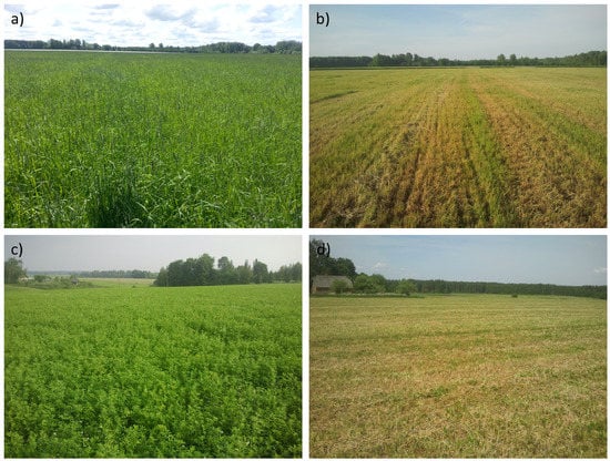
| We begin with KappaOne webinars. Do not miss your chance to participate in the very first on 30th of June 3pm EEST. Register here: https://forms.gle/cBdBpU39E8N1s54u7. In our first webinar our EO analyst Jelizaveta Vabištševitš is going to demonstrate how KappaOne facilitates subsidy checks under the CAP (common agricultural policy). Sentinel-1 is a radar satellite that works both day and night and can see through the clouds and is, therefore, an excellent source of data for monitoring changes in agricultural land. The KappaOne service is designed to make Sentinel-1 SAR data easily accessible and ready to be used and analysed. It is extremely helpful for the subsidy checks under the CAP. For example, it is valuable for planning field visits to the most problematic areas and getting an initial overview of the field before leaving the office. Moreover, it is applicable for checking the parcels manually, where the machine learning model gives an uncertain or borderline result. Sentinel-1 images are also well suited for assessment of mowing, harvesting, ploughing and other markers. | |
Kappamask, the most accurate cloudmask in Northern Europe | |
|
Perhaps
the most visible and ready to use product coming from us this year is
KappaMask Sentinel-2 cloud mask. It is useful for wide variety of users
from EO and non-EO sector. Everyone, who needs to use Sentinel-2 data in
large volumes and wants to separate cloud-free areas from cloudy ones,
will benefit from KappaMask. Though still in development, in our first focus area – Northern Europe, it already seems to be convincingly the most accurate free and open Sentinel-2 cloud mask. Read more about it from our recently published research paper: https://www.mdpi.com/2072-4292/13/20/4100 Try it out: https://github.com/kappazeta/cm_predict Or re-use our reference dataset: https://zenodo.org/record/5095024#.YP8HpY4zaUk First trials by users confirm that it even works outside the focus area – in Southern Europe. Though, with some land cover types, especially with water bodies it sometimes gives strange results. It is most likely due to the limitations of the reference set, where our model is fitted. We will address it in the 2nd phase of the project. The 2nd phase of the project has already started. The goal is very simple – to make KappaMask the most accurate free and open Sentinel-2 cloud mask globally in all seasons, not just for Northern European terrestrial summer season conditions. We are extending the reference set (manual labelling with clever active learning approach plus re-using free and open data sets by other teams) and improving the model. Next version of KappaMask will be released in summer 2022 – stay tuned. |
|
KappaZeta is making Sentinel-1 data very easy to useSentinel-1 analysis-ready data layers for B2B and B2G users | |
| Copernicus Sentinel satellites produce several terabytes of data every day. However, a significant portion of this data is under-utilized, because for many users the data is complex to understand and use. KappaZeta is addressing this problem for Sentinel-1 with pre-processing and providing the derived layers in an analysis-ready format. The goal is to have a service, where obtaining the right satellite image takes either a single mouse click or an API command. The vision will be implemented under the InCubed programme of European Space Agency, which is co-funding Earth Observation products and services development.
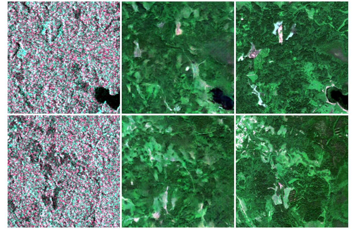
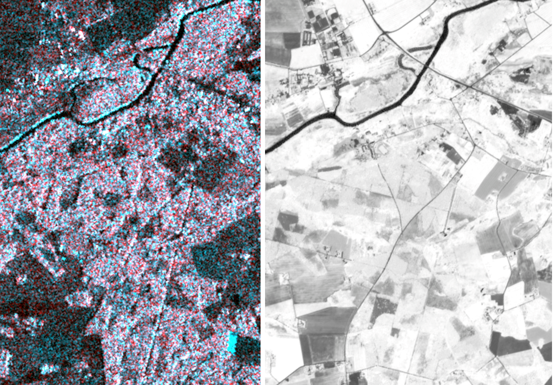
Sentinel-1 gathers data about the Earth very frequently (depending on the latitude 2-4 times per week), it “sees” through the clouds and works day and night independent of availability of sunlight. However, its radar “images” render a coarse resolution from microwave interaction with objects on the ground (see left column in the figure below). Sentinel-2 optical system on the other hand, produces reasonably colored images (right column in the figure below), but due to cloud cover the time series is often very sparse. In autumn one could wait for a cloud free image for more than a month. The solution developed by KappaZeta fuses optical and radar satellite imagery to produce frequent optical images – just like the Earth would look like from above (middle column in Figure 1).
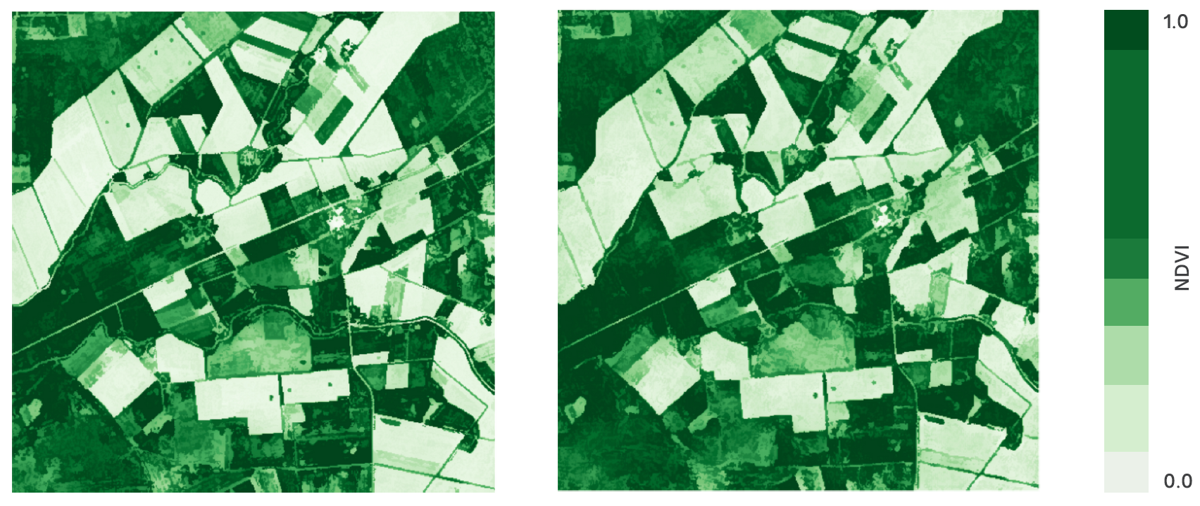
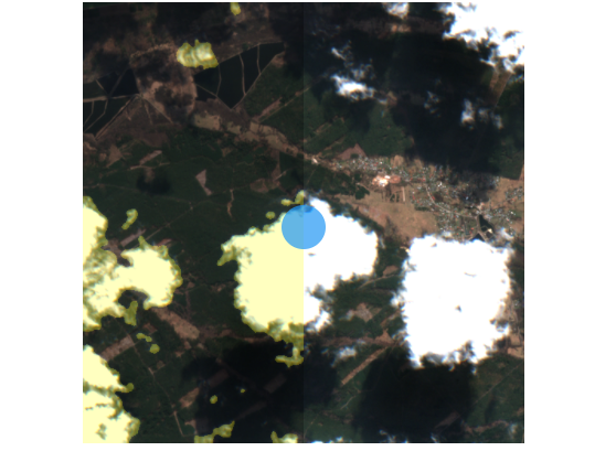
In total six special Sentinel-1 data layers are in development. Synthetic Sentinel-2 natural-coloured image is probably the most interesting for general public. Figure 1 presents the beta version of the service as it is today. As one could see, the synthesized and actual Sentinel-2 images look similar already. During next two years the AI models will be further developed prior to the service launch. The goal is a reasonable reproduction of Sentinel-2 images, while deriving information about the landscape status from the latest Sentinel-1 radar image. AI-modelled NDVI map is another interesting data layer currently in development. As one could see from Figure 2 the synthetic modelled biomass index estimate is very similar to the actual one. The advantage of the synthetic version is in temporal resolution. Sentinel-2 optical imagery is available only in clear weather conditions – in autumn it is 1-2 times per month or even less. It is too little for several operational applications including farm management. Sentinel-1 measurements and derived data layers (like the biomass index estimate in Figure 2 right) are much more frequent. Instead of 1-2 useful measurements per month you’ll get 2-4 updates per week, which is uttermost important for several applications to provide value in real world and not just a theoretical validation of the concept. The data layers in development (biomass estimate, interferometric coherence, natural colours satellite image etc) are vital input for a large variety of end-user services, including:
1. Farm management software – the farmer gets a better overview of the status of his/her fields and the changes in time, it is also a necessary input for additional analytics and AI models. E.g. to quickly find the fields which require the attention of agronomist and to perform intelligent evident-based decisions for future planning. 2. Agri-insurance – more accurate risk assessment based on field and farmer performance in past years, damage assessment for solving disputes and planning inspector visits. 3. Ministry of Environment – making its work faster and more effective. To plan the field surveys latest satellite image about situation of the landscape is vital input, historical images are necessary to solve the disputes about the use and potential abuse of natural resources. The decisions will be based more on direct evidence and less on gut feeling.
4. Environment management and spatial planning companies – the situation of the landscape of the area of interest and its seasonal dynamics are known directly from satellite imagery and not from indirect proxies, the conclusions are standing on stronger basis. Costly wrong decisions can be avoided. 5. Defence forces – fresh information about the conditions of the landscape, changes in military and civilian infrastructure. 6. Carbon trading – input data to model greenhouse gas emissions, sinks and stocks
For implementing the vision KappaZeta received 400 000 € investment from European Space Agency (ESA). Besides space exploration, commercialization and supporting space technology enterprises are priorities for ESA. Current development is a good example of space downstream application improving the life on Earth. On top of the ESA investment 100 000 € KappaZeta self-financing will be added, which is mainly covered from pre-purchase deals with service users. The development will run two years, but first data layer services will be launched already in 2022 spring. | Figure 1. Sentinel-1 radar image (left), synthetic Sentinel-2 like natural colours image created with AI (middle column) and actual Sentinel-2 image (right). Figure 2. NDVI computed from Sentinel-2 image (left) and synthetic NDVI modelled by KappaZeta using Sentinel-1 radar data (right). |
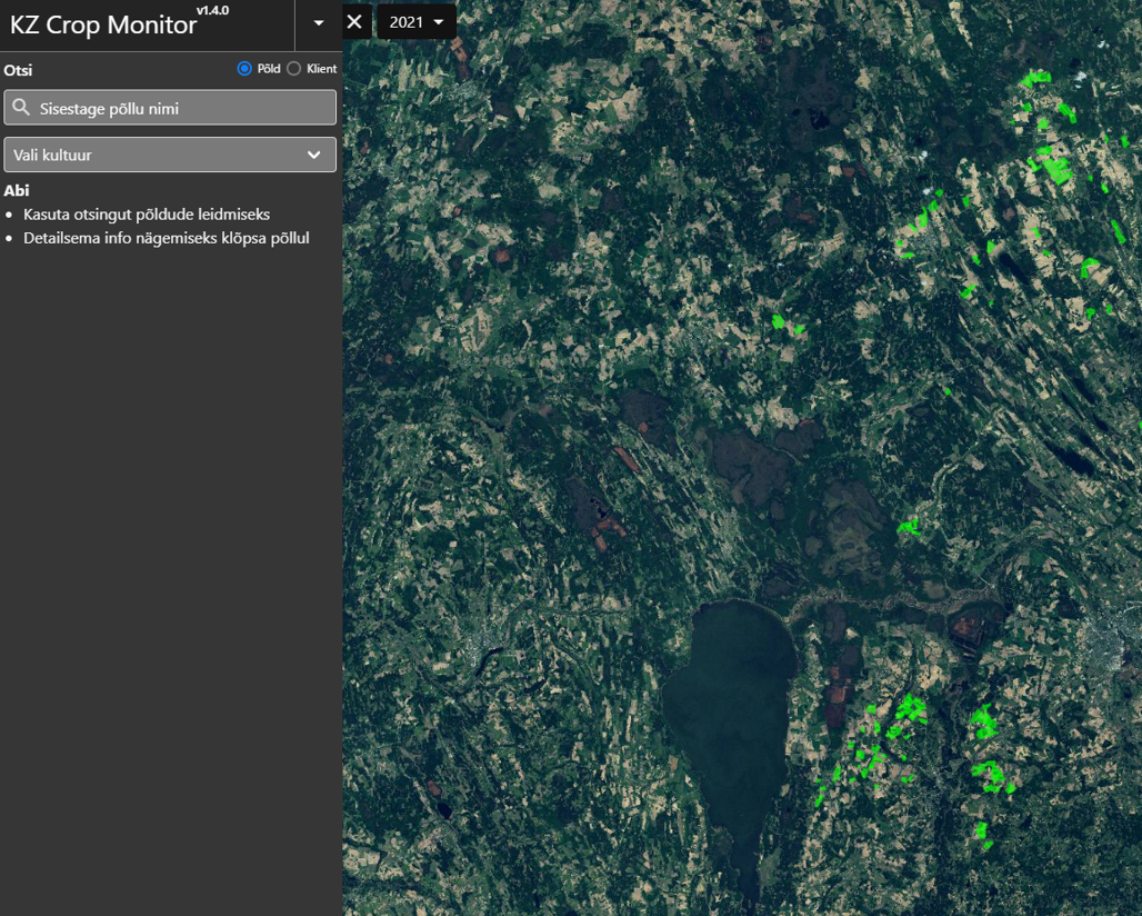
Our crop monitoring service prototype is liveIn the beginning of May we launched our crop monitoring prototype service. It is the first phase of the Harvesting Time Recommendation service prototype and allows the farmers to see the ongoing season timeseries of Sentinel-1 and Sentinel-2 field-based features and NDVI/RGB/NRG images which are being updated as soon as new images are available. | |
Synthetic NDVI for proxy biomass calculationsPlant biomass, an indicator of the ecological state of an area, can be modeled from the Normalized Difference Vegetation Index (NDVI). The ESA’s Sentinel-2 satellite provides NDVI data openly, but this is often obstructed by clouds. Hence, we developed an MVP to explore the modeling of NDVI from Sentinel-1 data using Generative Models. | |
Our new cloudmaskOn 23rd of April KappaZeta presented the Cloud Mask project results on Very High-resolution Radar & Optical Data Assessment (VH-RODA) 2021 workshop. We named our cloud classification mask KappaMask. Thus, we presented that our KappaMask outperformed Sen2Cor with 92% vs 57% dice coefficient on validation set. Check out our cloud mask comparison slider-pages with rule-based masks (Sen2Cor, Fmask) from here and machine learning-based Sinergise S2cloudless mask from here. | |
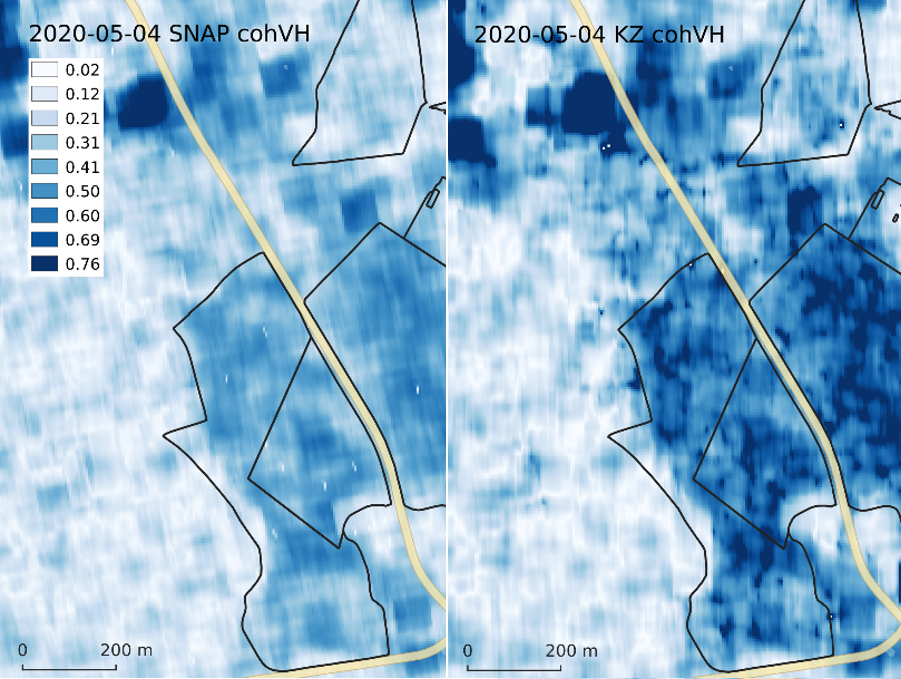
Advanced coherence rastersIt is a common understanding, that to reach a useful AI model, it is crucial to have validated ground reference data for training. Just as important is to have meaningful, calibrated, low noise features that have substantial physical relation to the phenomenon being modelled. At KappaZeta we are paying extra attention to get most out of Sentinel-1 SAR data. The figure below compares 6-day VH coherence from SNAP with the output from our processing chain. As you can see the spatial variability and the dynamic range from the KZ processor is much higher. | |
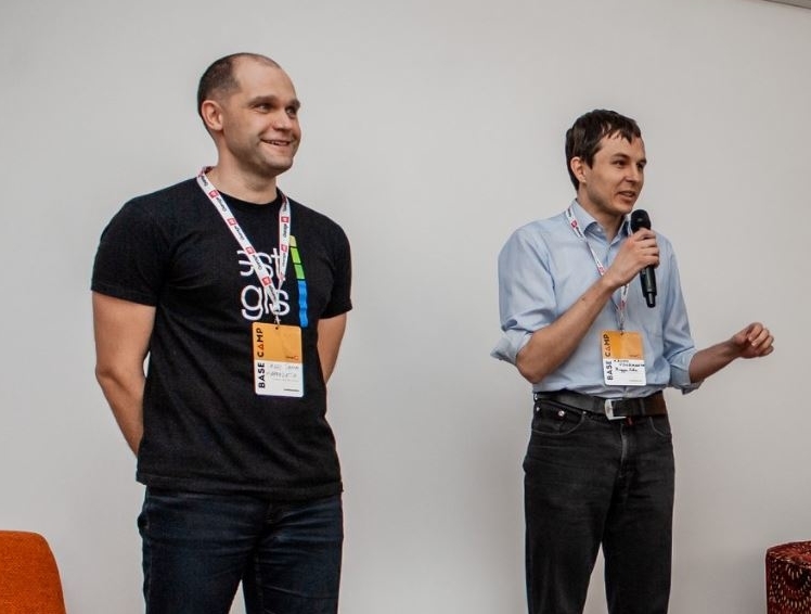
Geospatial Professionals in TartuOur founders Kaupo and Tanel talk in TartuGeo Podcast about their road to remote sensing, building KappaZeta and trends in Earth observation. | |
Our new articleFresh from the press. Here comes a new research paper from KappaZeta & our partners: https://www.mdpi.com/2072-4292/12/22/3784. We believe it is an important step for developing CAP monitoring in EU and other agricultural applications. You are welcome to use our work and reference back. | |
Kappazeta for agricultureThe pressure for adapting new sustainable methods of agricultural is greater than ever. Here industry of Earth Observation has an important role. KappaZeta team is proud to be part of this progress. Our mission is to utilize the great potential of ESA Copernicus Sentinel satellites. As radar remote sensing experts, we have much value to provide for agriculture. See this video to learn about our role in “National Programme for Addressing Socio-Economic Challenges through R&D”. | |
Award from Baltic AssemblyOn 5th of November KappaZeta received the Baltic Innovation Award from the Baltic Assembly. Our CTO, Tanel Tamm was there to receive it. We are thankful and will stay innovative. |
|