


How scientific remote-sensing expertise, high-quality preprocessing and regional knowledge turn satellite observations into results paying agencies can trust.
When people hear “Area Monitoring System” (AMS), attention often turns immediately to artificial intelligence and machine learning. But a model can only interpret the information it receives. If clouds are not detected, radar noise is not corrected, observations are misaligned, or regional agricultural conditions are poorly represented, even a sophisticated model can produce unreliable results.
Reliable AMS therefore starts long before machine learning. It starts with understanding the satellite signal, preparing the data and designing the monitoring method around the agricultural and operational reality of the paying agency.
Kappazeta’s agricultural monitoring methods are backed by scientific expertise in radar remote sensing and geoinformatics, multi-year research into satellite-based detection of agricultural activities, and experience translating those methods into operational monitoring workflows.
AREA MONITORING SYSTEM (AMS) IN ONE SENTENCE
An Area Monitoring System, or AMS, uses regular and systematic satellite observations to assess agricultural activities and practices on agricultural land.
Why AMS matters
National agricultural monitoring is a scale problem. Field inspections provide valuable evidence but require significant expert human resources to cover every agricultural parcel. AMS gives paying agencies a consistent way to screen large areas, identify cases requiring attention, and support decisions with observations collected throughout the season.
A well-designed AMS also improves the service around agricultural payments. Earlier and more consistent information can help agencies detect data-quality issues, direct expert attention to uncertain cases, and communicate results more clearly. The purpose is not simply to automate an existing control. It is to create a timelier and more evidence-based workflow for agencies and farmers.
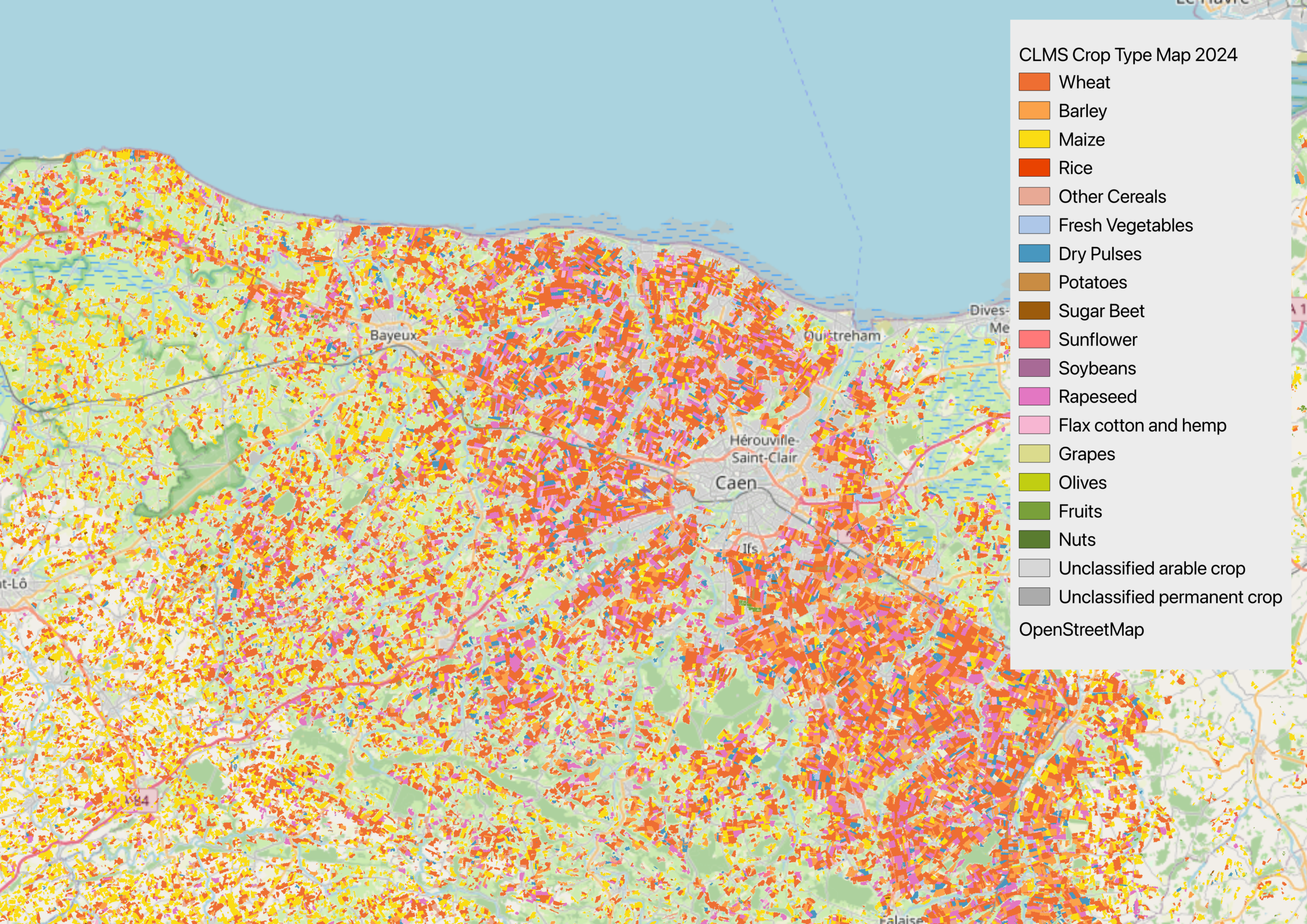
The challenges of monitoring agriculture from space
Agricultural monitoring may sound straightforward: obtain an image, analyze the field, and report the result.
However, it sounds easier said than done – Input SAR and optical data can be affected by clouds, rainfall, soil conditions, parcel geometry, crop development, farming practices, sensor characteristics, global and the timing of satellite acquisitions.
The same activity can appear differently between countries and even between seasons. A dry spring, a wet summer or an unusually early harvest can shift the patterns a model has learned. Small or irregular parcels can also be difficult to analyse because boundary pixels may include roads, trees, or neighbouring fields.
| Monitoring challenge | Why it matters |
| Cloud cover | Optical observations may be unavailable at important moments. |
| Noisy or misaligned data | Artefacts can be mistaken for agricultural change. |
| Regional differences | Crop calendars, soils and practices vary between locations. |
| Year-to-year variability | Weather changes the seasonal pattern seen by the model. |
| Operational deadlines | Results must be processed, checked, and delivered on schedule. |
Why one-size-fits-all machine learning does not work
Global models are useful because they expose an algorithm to a broad range of landscapes and conditions. However, breadth alone does not guarantee that a model understands the agricultural reality of a particular country. Grassland management, crop rotations, soils, weather, and the timing of agricultural activities can all differ significantly.
In Kappazeta we combine transferable methods with regional calibration. Multi-country and multi-year training data provide a strong base, while local examples and paying agency expertise help train the system for the conditions in which it operates. Local adaptation may include region-specific training samples, thresholds, seasonal windows, auxiliary datasets, and validation rules.
THE PRINCIPLE
Use broad experience to build a robust starting point, then adapt and validate the service using local agricultural conditions and representative reference data.
Optical and SAR: why both are needed
Optical satellites such as Sentinel-2 describe reflected light. They are highly useful for observing vegetation conditions, crop development and changes in the appearance of a field. Their principal limitation is cloud cover, which can interrupt the time series during critical periods.
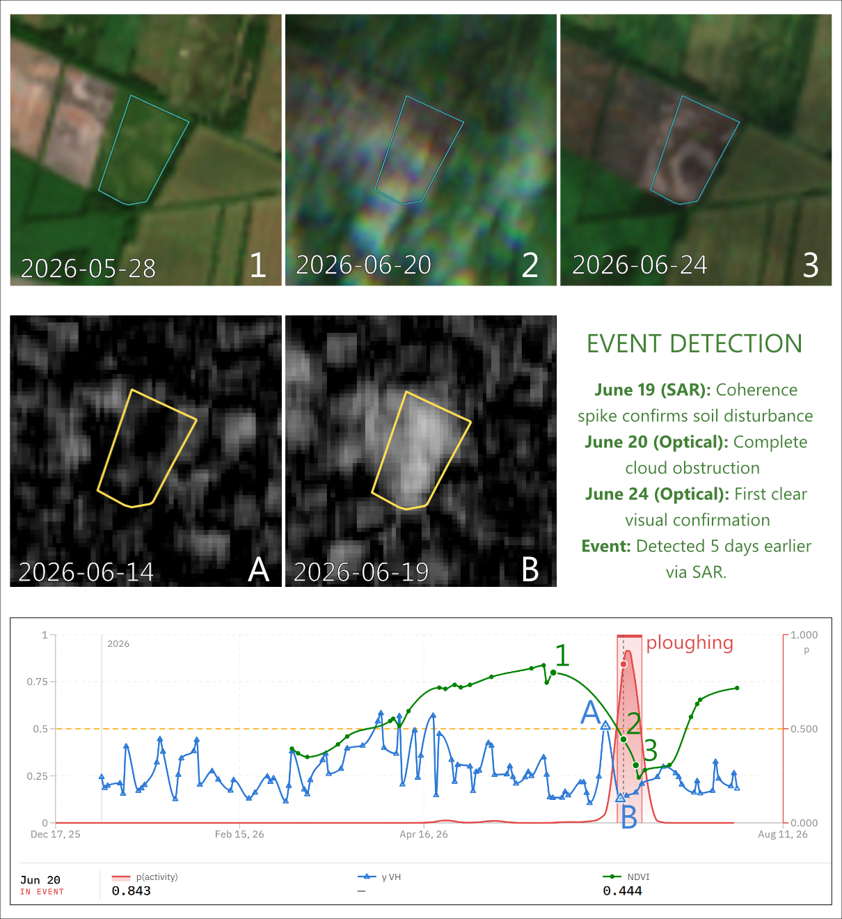
Synthetic Aperture Radar, or SAR, works differently. Sentinel-1 radar observations are available through clouds and without daylight. Radar backscatter and coherence provide information related to field structure and changes over time, which makes SAR especially valuable for event detection during cloudier seasons and in cloudier regions.
SAR is not a shortcut.
Radar imagery contains speckle and can be affected by thermal noise, terrain and other processing effects. It needs specialist calibration and filtering before small agricultural changes can be interpreted reliably. Kappazeta’s SAR expertise focuses on producing stable parcel-level time series that preserve useful detail while reducing noise.
| Source | Strength | Main issue |
| Optical | Rich information about vegetation and surface reflectance | Clouds create gaps in the seasonal record |
| SAR | All-weather observations and sensitivity to structural change | Specialist preprocessing is essential |
| Combined | Complementary evidence and a more resilient time series | Signals must be calibrated and interpreted together |
What makes AMS results trustworthy?
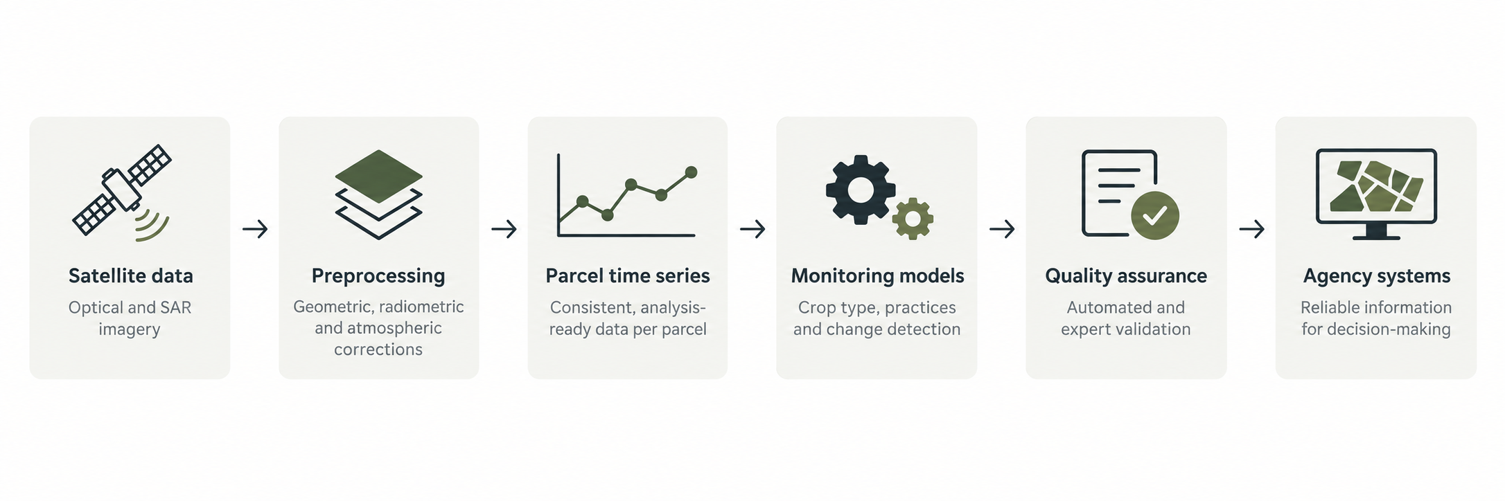
Accuracy does not begin with a classifier. It begins with the condition of the data entering the analysis. An undetected cloud, a shifted pixel, a sensor difference or radar noise can create a false change or hide a real one. This is why we treat preprocessing, quality control and delivery as equal parts of the monitoring method:
- Analysis-ready data. Optical and radar observations are corrected and harmonised before they reach the monitoring model.
- Clean time series. Cloud effects, noise, outliers, and irregular observation intervals are handled so that seasonal changes can be compared consistently.
- Regional validation. Models are tested against relevant years, regions, parcel types, and agricultural practices.
- Traceable outputs. Results should include the information needed to understand what was processed, when it was processed, and how the conclusion was reached.
- Operational quality control. Input data, processing status, intermediate outputs, and final deliveries are checked throughout the workflow.
- Modular improvement. Individual preprocessing, quality-control or analysis components can be improved without replacing the complete system.
What paying agencies can do to improve AMS performance
The quality of AMS depends on more than the technology supplier. Paying agencies provide regulatory definitions, parcel information, reference data, and operational context that allow the system to produce useful results. The strongest implementations are therefore collaborative.
- Define eligibility conditions and expected outputs clearly, including the treatment of uncertain and non-monitorable cases.
- Provide timely, versioned parcel geometries and declarations with stable identifiers and documented changes.
- Share representative, quality-checked reference data covering regions, farming practices, parcel types, weather conditions, and multiple years.
- Agree acceptance criteria and quality metrics before operational delivery, including how false positives and false negatives will be evaluated.
- Plan integration early, including data schemas, validation rules, delivery frequency, interfaces, audit information and access rights.
- Keep agricultural and control experts involved when difficult signals are interpreted, and improvements are prioritized.
- Use pilots and staged deliveries to validate the complete workflow before the most time-critical part of the season.
What to look for in an AMS partner
An AMS tender should evaluate the complete operational service, not only a model demonstration. Paying agencies should ask how the proposed system performs when imagery is delayed, formats change, parcel geometries are updated, clouds persist, or a result is challenged.
- Relevant national or regional monitoring experience and evidence from operational agricultural seasons.
- Control of the preprocessing and analysis chain, supported by specialists who can diagnose data and model issues.
- A documented approach to regional adaptation, multi-year validation, and controlled model updates.
- Transparent quality assurance, traceable results and clear issue management responsibilities.
- Secure and scalable delivery that fits the agency’s systems and seasonal deadlines.
- A collaborative approach that gives the paying agency visibility into the methods, assumptions and improvement priorities.
Kappazeta’s AMS experience
Kappazeta’s agricultural monitoring work includes mowing, ploughing, harvesting, and grazing detection, crop classification, and related parcel-level analysis. Our experience includes methods developed from 2016 onward and training datasets representing multiple countries and agricultural seasons.
Built on scientific foundations
Kappazeta was not built around applying an off-the-shelf model to satellite images. It grew from scientific work in radar remote sensing, geoinformatics, and agricultural monitoring. Co-founders Kaupo Voormansik and Tanel Tamm both hold PhDs in fields directly relevant to Earth Observation (radar remote sensing and geoinformatics respectively) and have contributed to peer-reviewed research on the use of satellite data for agricultural monitoring.
This scientific foundation continues to shape how Kappazeta develops operational services. We begin by understanding the physical satellite signal and the factors that can distort it. We then prepare the data, adapt the method to local agricultural conditions, and validate the complete workflow before relying on its outputs. Machine learning is an important part of the solution, but it cannot compensate for unsuitable input data, weak reference information, or insufficient validation.
Kappazeta combines this scientific depth with experience in operational delivery. We work with optical and SAR data, develop region-specific machine-learning methods, and build repeatable processing chains for national-scale analysis. This allows us to address the full path from incoming satellite observations to traceable results that a paying agency can review and integrate.
Looking ahead
AMS is now part of the operational landscape of agricultural administration. The next challenge is to make monitoring more useful: covering additional eligibility conditions, improving interoperability, reducing avoidable manual work and turning Earth Observation data into information that agencies and farmers can act on.
Our approach combines region-specific machine learning, optical and SAR expertise, analysis-ready time series, and operational delivery. We believe reliable AMS is not created by one algorithm. It is built as a complete chain of evidence around local conditions, transparent quality controls, and the decisions a paying agency must make.
Let’s discuss your AMS! Are you preparing an AMS procurement, reviewing an existing service or exploring new monitoring tasks? Contact Kappazeta to discuss regional calibration, sensor fusion, quality assurance, and integration with your operational workflow.
