
Exciting remote sensing news from last year. Canadian Space Agency has launched new generation of Earth observation satellites called The RADARSAT Constellation Mission (RCM) on June 12, 2019 aboard a SpaceX Falcon 9 rocket. It became operational in December 2019 and provides data continuity to RADARSAT-1 (not operational anymore) and RADARSAT-2 (still operational) users.

RCM is a combination of three identical and equally spaced satellites, flying in the same orbit plane 32 minutes apart at an altitude of 600 km. Each of the spacecraft carries Synthetic Aperture Radar (SAR) aboard, plus a secondary sensor for Automatic Identification System (AIS) for ships. When RADARSAT-2 has left- and right-looking operation, then RCM is only right-looking, because multiple satellites increase revisit times and eliminate the need to look both ways. The SAR device aboard RCM satellites is quite similar to RADARSAT-2 – C-Band antenna, 100 MHz bandwidth, 4 regular polarization modes (HH, VV, HV, VH) plus compact polarimetry. Polarization isolation is slightly better: >30 dB. See detailed comparison of RADARSAT satellites here.
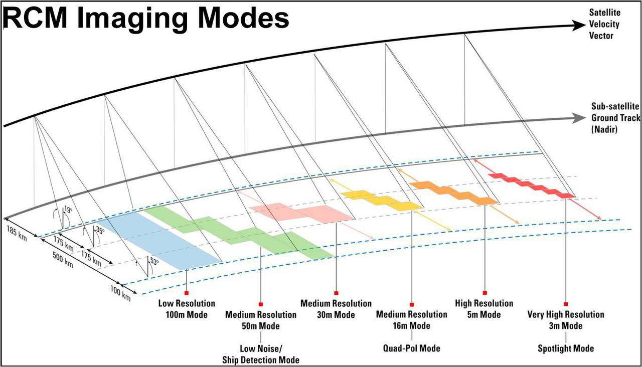
The constellation system provides better coverage with smaller and less expensive satellites. This configuration allows for daily revisits of Canada’s territory, as well as daily access to 90% of the world’s surface. RCM can provide a four-day exact revisit (3 satellites equally phased in a 12 day repeat cycle orbit), allowing coherent change detection with InSAR. For specific applications (ship detection, maritime surveillance) data latency from acquisition to delivery can be only 10-30 minutes, but in general it will be from hours to 1 day. RCM has several observation modes, but the mission is primarily designed for medium-resolution monitoring:
- Low resolution (100 m), swath 500 km, NESZ -22 dB
- Medium resolution (16, 30, 50 m), swath 30-350 km, NESZ -25…-22 dB
- High and very high resolution (3-5 m), swath 20-30 km, NESZ -17..-19 dB
- Spotlight (1×3 m), swath 20 km, NESZ -17 dB
RCM data takes are led and planned by Canadian Space Agency and they are meant to contribute to Government of Canada interests over the country territories. Focus is on maritime surveillance (ship detection, ice charts), disaster management and ecosystem monitoring. In agriculture, the data is used for producing yearly crop inventory.
Although access to RCM images are free to users, it’s not that straight-forward if you are from non-federal government organizations or foreign private company. The RCM system and its data are used first and foremost in support of Government of Canada services and needs, but certain products are available to users outside the Government of Canada. To become a public user, you need to create account at Earth Observation Data Management System (EODMS).
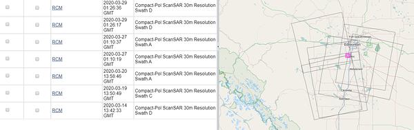
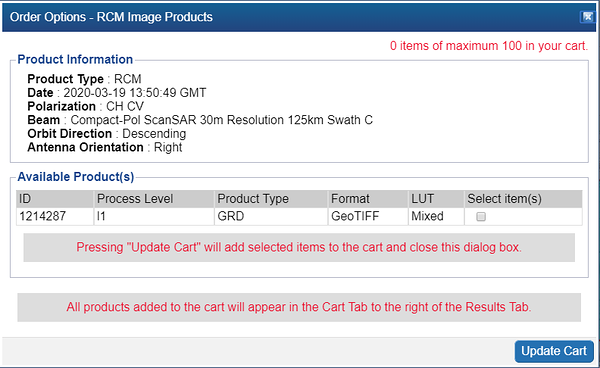
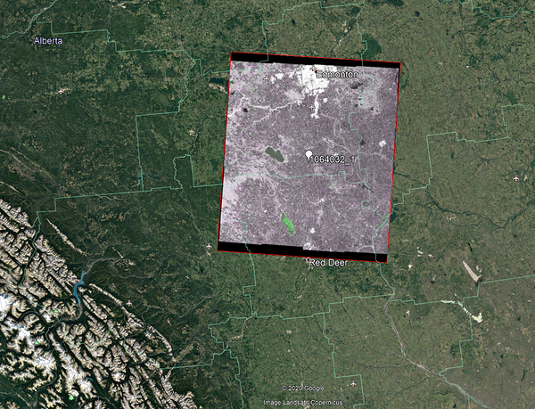
The first message for the public users is the following: “Registered public users will be able to download RCM products which are limited to the following regions and resolutions only : Canada Land – coarser than or equal to 16 m. and World Maritime – coarser than or equal to 100 m. Products over World Land excluding Canada will not be available.” We tried out a small area in Alberta province near Edmonton (the province with most farms in Canada). For March 2020 we could get Medium Resolution 30 m RCM images for 5 dates (see example of the product below). It’s not raw data, but GeoTIFF images. Actually 2 images, one for CH and other for CV polarization.
RADARSAT-2 raw data footprints and quicklooks can be viewed in the same portal, but ordering process goes through RADARSAT-2 portal, which is handled by MDA Corporation.
