
Written by Catherine Odera, EO projects manager at KappaZeta
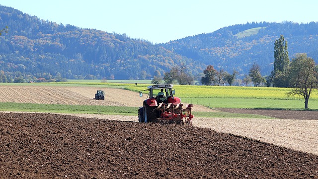
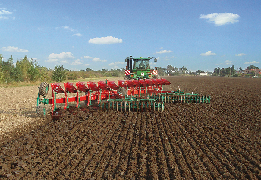
Tillage is the turning of soil during land preparation for farming, and this necessary agricultural practice comes with a price. The more intense the tillage, the more the carbon stored in the soil is released into the atmosphere. Tillage practices also influence soil health, affecting erosion rates and the distribution of nutrients. KappaZeta is on a mission to detect different types of tillage by combining satellite imagery and AI. The information from detecting, classifying and monitoring tillage practices can then be used to reward farmers for low-impact tillage practices.
Conventional tillage and conservation tillage
Broadly, tillage practices can be categorized into conservation and conventional tillage. Conservation tillage is a method that maintains permanent or semi-permanent soil coverage, thereby promoting soil health and minimizing erosion. Practices under this category, such as no-tillage, mulch tillage, and ridge tillage, aim to enhance soil conservation and improve crop yields. These methods ensure minimal soil disturbance, preserve soil structure, enhance water retention, and support biodiversity. In contrast, conventional tillage is known for its intensive soil disturbance. This widespread method can negatively impact biodiversity, disrupt soil nutrient balance, and increase GHG emissions. The adverse effects on soil structure and function emphasize the importance of monitoring and exploring sustainable alternatives, i.e., conservation tillage.

Can tillage intensity be seen from space?
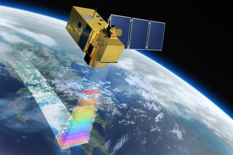
Earth observation, coupled with Artificial Intelligence (AI), provides a powerful tool for identifying and classifying tillage practices. It aids in analyzing and capturing changes in land surface characteristics such as residue presence, as well as field patterns. Satellite sensors, e.g., Sentinel-2 and Landsat, along with their derived indices, are instrumental in tillage detection.
Some examples of important Sentinel-2 and Landsat-related indices are highlighted below:
- Normalized Difference Vegetation Difference (NDVI)
- Normalized Difference Tillage Index (NDTI)
- Crop Residue Cover Index (CRCI)
- Crop Residue Cover (CRC)
- Normalized Difference Index 5 (NDI5)
- Normalized Difference Index 7 (NDI7)
- Normalized Difference Residue Index (NDRI)
- Simulated Cellulose Absorption Index (BI1)
- Simulated Lignin Cellulose Absorption (BI2)
The indices, derived using various Landsat and Sentinel-2 spectral bands, are essential in highlighting vegetation health, soil differences, and cellulose degradation, aiding in the identification and differentiation of tillage practices. Moreover, the integration of Synthetic Aperture Radar (SAR) data, such as Sentinel-1, enables continuous monitoring regardless of weather conditions, capturing surface changes indicative of tillage activities.
While Earth observation offers valuable information, it faces challenges, especially in regions with small field sizes or where distinguishing between crop residues and soil is difficult. However, the integration of AI algorithms and advanced data fusion models has significantly improved tillage detection accuracy, facilitating more precise tillage mapping.
In conclusion, the integration of Earth observation technologies and AI algorithms holds great potential for effectively identifying, classifying, and monitoring tillage practices. This comprehensive understanding is crucial for promoting sustainable agricultural management and conservation efforts, ultimately contributing to improved agricultural and climate policies.
Conservation tillage feasibility study by KappaZeta
As the spectral signature of conservation tillage practices has not been extensively researched, a feasibility study was undertaken to assess the possibility of detecting different tillage practices using various vegetation indices mentioned in scientific papers. Once the most suitable vegetation indices were identified through the feasibility study, the subsequent step would be developing a conservation tillage detection model.
To ensure that the observed patterns remained consistent and not overly dependent on a particular season, data from multiple years was incorporated into the analysis. However, some seasonal influences cannot be entirely ruled out. A total of 8766 data points sampled in Finland (2020-2021), Estonia (2018-2022), Denmark (2022), Sweden (2021-2022) and Lithuania (2022) were used in the study. Data from Poland and Northern Germany was not included as we are still working on acquiring data from both countries.
Upon concluding the feasibility study, we discovered that it is possible to distinguish conventional tillage from conservation tillage.
Next steps and call for contributions
Future work includes improving the conventional tillage detection model and assessing the model’s performance in Estonia, Latvia, Lithuania, Finland, Sweden, Denmark, Poland, and Northern Germany. A conservation tillage detection model is also currently in development.
The main factor limiting development of very accurate tillage detection models, and especially for detecting conservation tillage, is the insufficient amount of trustworthy ground truth data available to us. We’re grateful for any helpful information related to ground reference data for different tillage practices.
If you have any questions or collaboration ideas, we would love to hear from you!
Please feel free to reach out Catherine via email at catherine.odera@kappazeta.ee.