

Defence & Intelligence
Kappazeta presents a range of situational awareness solutions aimed at enhancing regional defence and security capabilities.
Landscape Trafficability
Deforestation & Disturbance Monitoring
Flood Detection
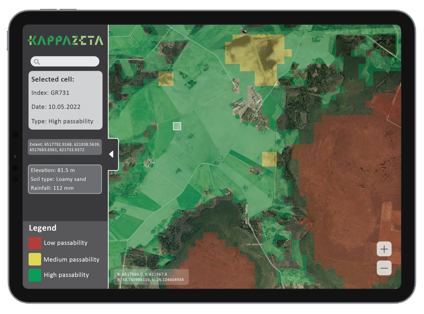
LANDSCAPE TRAFFICABILITY
Capability to monitor landscape passability for the logistics purposes of military units. Near real-time information of passability is needed due to changing weather conditions and their effects on the land surface.
The purpose of this solution is for the Defence Forces to gain an understanding of how to better plan infantry and machinery logistics and anticipate enemy movements.
DEFORESTATION & DISTURBANCE MONITORING
The service identifies forest areas where recent clear-cutting has taken place. This is a solution for a situation where the forest cutting data is not available due to inaccuracies of forest harvesting declarations to the government.
Situational awareness of clearcuts serves as an early warning system of potential preparation for military activities in strategic areas. It can also assist in determining which areas provide enough cover, better plan areas for military trainings and planning of infantry and machinery logistics.
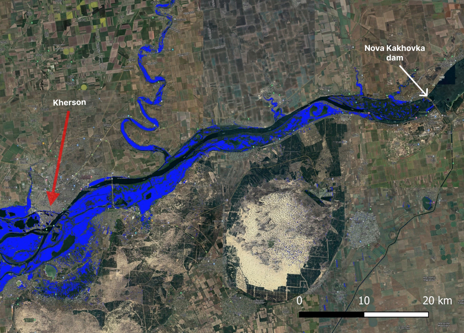
FLOOD DETECTION
Capability to monitor flooded areas caused by major downpours or destruction of dams. Understand which areas have been affected the most.
Detection of flooded areas enables swift and adept actions by first responders. This ensures the effective utilization of emergency resources with the most current data.
Get in touch with the team


Jürgen Lina
Head of Product Strategy, Defence

Erik Ehasoo
3D-SAR Business Lead