

A complete satellite-based grassland monitoring service
Duration: 2020–2021Funder: European Space Agency
Grazing detection from Copernicus data for agricultural subsidy checks is a project carried out in collaboration with the European Space Agency (ESA) and with our partner, Czech EO company Gisat s.r.o. The project started in October 2020 and will finish in November 2021.
The aim is to develop a complete satellite-based grassland monitoring
service, where grazing detection is equally needed alongside mowing
detection and reducing the need for field surveys.
Grazing
detection service is urgently needed for the monitoring approach reform
of the Common Agricultural Policy (CAP). With the reform, the current
method of on the spot
checks (OTSC) will be gradually replaced with satellite monitoring. One
of the most common requirements under CAP that needs to be checked is
grassland maintenance, which can be performed by either mowing or
grazing. To provide a complete satellite-based grassland monitoring
service, grazing detection is equally needed alongside mowing detection.
Without the grazing detection, complete grassland maintenance checks
cannot be performed with satellite monitoring, as a significant part
(~20%) of the European grasslands are being grazed.
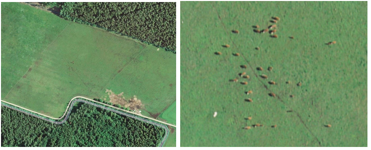
Source: Estonian orthophoto, Land Board
Our aim is to develop a grazing detection methodology based on Copernicus data (Sentinel-1 and Sentinel-2 imagery time series). We are planning to test the methodology with selected European national paying agencies (NPAs) and further aim is prototype development for public sector applications.
Planned outcomes:
Develop grazing detection methodology based on Copernicus data (Sentinel-1 and Sentinel-2 imagery time series).
Provide the NPA operators means to carry out checks on grasslands using EO data and substituting on the spot checks of grassland grazing activity with new EO data based grazing detection methodology.
Close the grasslands subsidy checks case for CAP satellite monitoring.
The timeline of the project is presented in the table below.
Activity | Time |
2020 inspector’s and farmers’ logs and field books collection | October-November 2020 |
Access to WMS services of Denmark, Sweden, Estonia. Counting animals per parcel from orthophotos. | November-December 2020 |
Analyzing 2020 inspector’s and farmers’ logs and field books respect to detected grazing events, satellite data processing, time series generation and grazing algorithm development | January-March 2021 |
Running grazing detection system and validating the results on 2020 dataset | March-April 2021 |
Collecting grazing in situ data in Estonia | May-August 2021 |
Submitting grazing detection results based on 2020 dataset | November 2021 |
Submitting final validation report about Denmark 2020 | November 2021 |
For more information, contact jelizaveta.vabistsevits@kappazeta.ee.