
This is Part 1 of our series on looking into our trafficability mapping solution. See Part 2. Soil Moisture Information for Trafficability Mapping here.
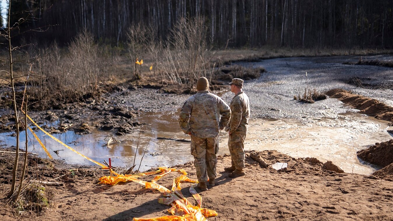
In March 2025, four U.S. military soldiers taking part of the excercise in Lithuania encountered an unfortunate incident that led to the loss of four soldiers. Their armored vehicle became immobilized in a peat bog in Lithuania as reported by The New York Times.
This is precisely the challenge we aim to solve with our trafficability solution – to assist military personnel in planning operations more effectively and avoiding terrain-related hazards along their routes. Weather can quickly change landscape trafficability, and decisions still too often rely on experience and intuition alone. An Earth observation–driven approach provides timely, map-based tool to plan safer routes, reduce delays, and avoid costly recoveries.
Kappazeta is developing an Earth observation (EO) open-landscape trafficability solution—funded by the European Space Agency (ESA)—to deliver actionable go / slow-go / no-go assessments for defence and, increasingly, agriculture.
Trafficability Mapping for Defence Applications
The main goal of this solution is to support national security applications by enhancing operational planning, improving resource allocation, supporting emergency and disaster response, coordinating more effectively with military operations and protecting critical infrastructure. In addition, trafficability maps contribute to national emergency preparedness by identifying potential bottlenecks and vulnerabilities in the transportation network and enable authorities to develop contingency plans for maintaining mobility and access during crises.
Currently, trafficability for military applications is measured by a driver’s experience and gut feeling which can be affected by human error and bias. Developing an accurate and reliable trafficability map containing information on vehicle types, covering large tracts of land and classifying the terrain into go, slow-go and no-go will significantly enhance situational awareness and expedite the decision-making process during military operations.
Trafficability Mapping for Agricultural Applications
In addition to the defence use cases, trafficability mapping is proving to be a game-changer in precision agriculture. Based on agriculture domain experts, trafficability estimations are currently being carried out through onsite checking and analysing previous weather conditions which at times can be unreliable.
EO–based Trafficability maps provide farmers with detailed, field-level information such as current and future soil moisture and ground conditions that the human eye cannot detect. By identifying where soil is too wet or too dry, trafficability maps prevent heavy machinery from getting stuck or avoiding operations on overly wet soils. Agricultural operations on overly dry soils lead to soil compaction which damages soil structure and reduces its ability to hold nutrients and water. Soil compaction occurs due to the pressure exerted by agricultural vehicles as they traverse the terrain. Since some agricultural vehicles are as heavy as military ones and military operations occasionally require vehicles to cross agricultural fields.
With this knowledge, agricultural experts can make smarter decisions about when and where to apply water, fertilizer, or pesticides to help reduce waste, save costs, and protect the environment. Better planning ensures planting, harvesting, and fertilizer application happens at the right time, leading to higher yields and more sustainable farming practices. The maps also support conservation tillage by identifying areas where reduced tilling is possible, helping to minimize erosion, improve soil health, and support carbon sequestration.
How the Trafficability Solution Works
The open landscape trafficability solution is built on three key components:
- Open area land cover map
- Open area soil moisture map
- Open area trafficability map
The open land cover map development has already been finalized using Earth Observation data, including Sentinel-2, Sentinel-1, and ESA WorldCover. The project’s areas of interest (AOI) span 12 European countries, including major parts of Estonia and selected areas of Finland, Latvia, Lithuania, Germany, Romania, Poland, France, Spain, Denmark, the Netherlands, and Ukraine.
Below are some examples of the model’s predictions across Estonia:
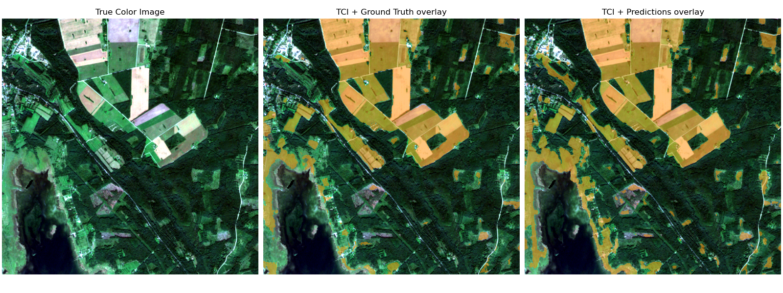
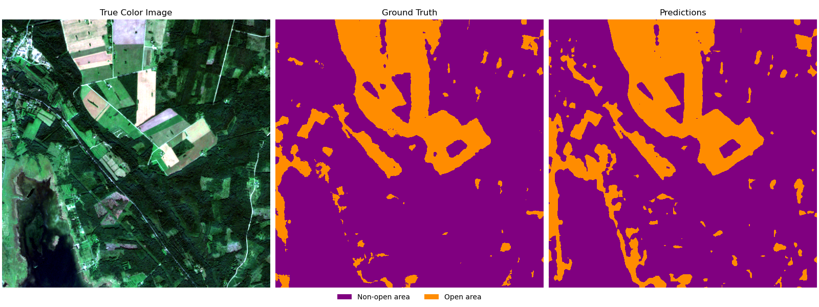
Open Land Cover Model’s Performance
The table below summarizes the model’s performance in all 12 countries across 2018–2021, measured by Precision, Recall, and F1-score.
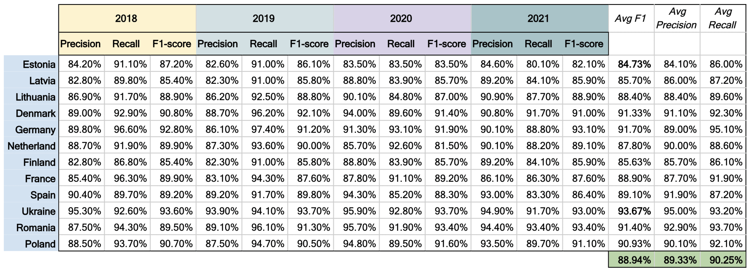
On average, the model achieved:
- Precision: 88.94%
- Recall: 89.33%
- F1-score: 90.25%
These results demonstrate the reliability of the model across diverse regions and conditions.
Next Steps
Open areas such as agricultural fields, undeveloped land, and grasslands are far more than just “empty land.” They are valuable resources that support food security, national security, and long-term sustainability.
The next phase of the project focuses on developing the open area soil moisture model, which will further enhance the trafficability solution by adding dynamic soil condition information.
Read more on Part 2. Soil Moisture Information for Trafficability Mapping here.
For more information on our trafficability map and other Defence solutions see here or get in touch with us on kappazeta.ee