
Actionable Land Monitoring solutions
KappaZeta's AI-driven satellite insights help governments and businesses make fact-based decisions and save time on analyzing vast amounts of data globally.
KappaZeta's AI-driven satellite insights help governments and businesses make fact-based decisions and save time on analyzing vast amounts of data globally.


Products our customers rely on daily
Actionable insights at your fingertips without spending resources on physical in-situ inspections.

Scientific Remote Sensing Expertise
Global Coverage
Near real-time and historical data
User-centric
Flexible and agile


Exploring the Significance of Open Landscape for Trafficability Mapping
Blog

Back to work! 📰 Our Quarterly Newsletter is Back...
Newsletter

How to Procure Earth Observation and Machine Learning Services Effectively
Blog

Detecting tillage intensity from space
Blog

KappaZeta grows agricultural expertise
Newsletter
Five new satellite analytics tools for agriculture
Blog

Five satellite analytics tools for agriculture
Newsletter

Thank you for following KappaZeta's story! We really app...
Newsletter

Martin Jüssi joins KappaZeta
Newsletter

Adventures in the realm of Synthetic NDVI
Blog

KappaZeta is hiring!
Newsletter

First investment round successful
Newsletter
KappaMask over Europe
Newsletter

SERA presentation day in Tallinn
Newsletter

A story of starting a satellite mission by Kaupo Voorman...
Newsletter

SNDVI: Synthesized NDVI (from SAR)
Blog

A new satellite mission: Sentinel-1 data to 3DWe are exc...
Newsletter

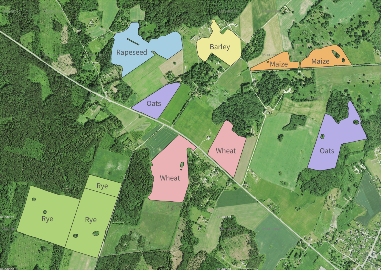
CropCop services for crop insuranceThe process of on-sit...
Newsletter